When It Comes to Large-Scale Solar, Show, Don't (Just) Tell

Resistance to a proposed solar project can be based on any number of factors. In an earlier post, I highlighted the importance of stakeholder outreach in planning for large-scale solar development. But even with thoughtful engagement and information coming from trusted sources, a significant segment of the local community could still be opposed to a new project.
Visualize Proposed Projects Accurately to Prevent Opposition
Often, people simply don't like the idea of seeing whatever it is that's proposed. Or, rather, they don't like the idea of seeing what it is they're envisioning, which might not be what is proposed.
Typical planning processes often invite such scenarios. A project is announced, permitting procedures initiated, and anyone with concerns has a lot of time to picture the worst before the release of an impact assessment that includes simulations. The longer that the only visual referent is imagined, the more it becomes a socially constructed reality — and the harder it will be to establish a conception of the project as it might appear. Entrenched opposition can result from prolonged misunderstanding.
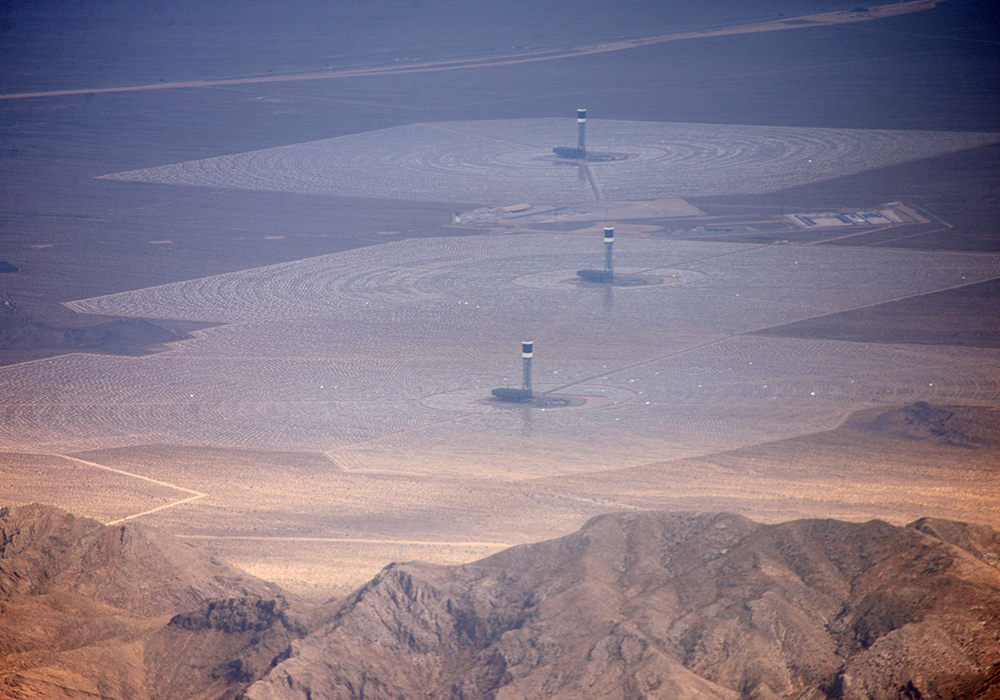
Solar projects, particularly when they are new to a community, are not helped by the prevalence of photographs that allow for great exaggeration. You've probably seen pictures of the (relatively few) concentrating solar power plants in the western U.S. These "power tower" facilities, of which the Ivanpah Solar Energy Generating Station is the most famous, are massive in scale and memorable in the image. So much so that if you've seen them (or, say, watched Blade Runner 2049), they might jump to mind as soon as the words "large-scale solar" are heard. And if you were a resident organizing opposition to a project, you might attach some images of them to your latest note to the neighborhood. Even modestly sized solar PV projects can indeed alter local landscapes, but it's in the best interest of all parties to clarify as soon as possible what exactly is being proposed.

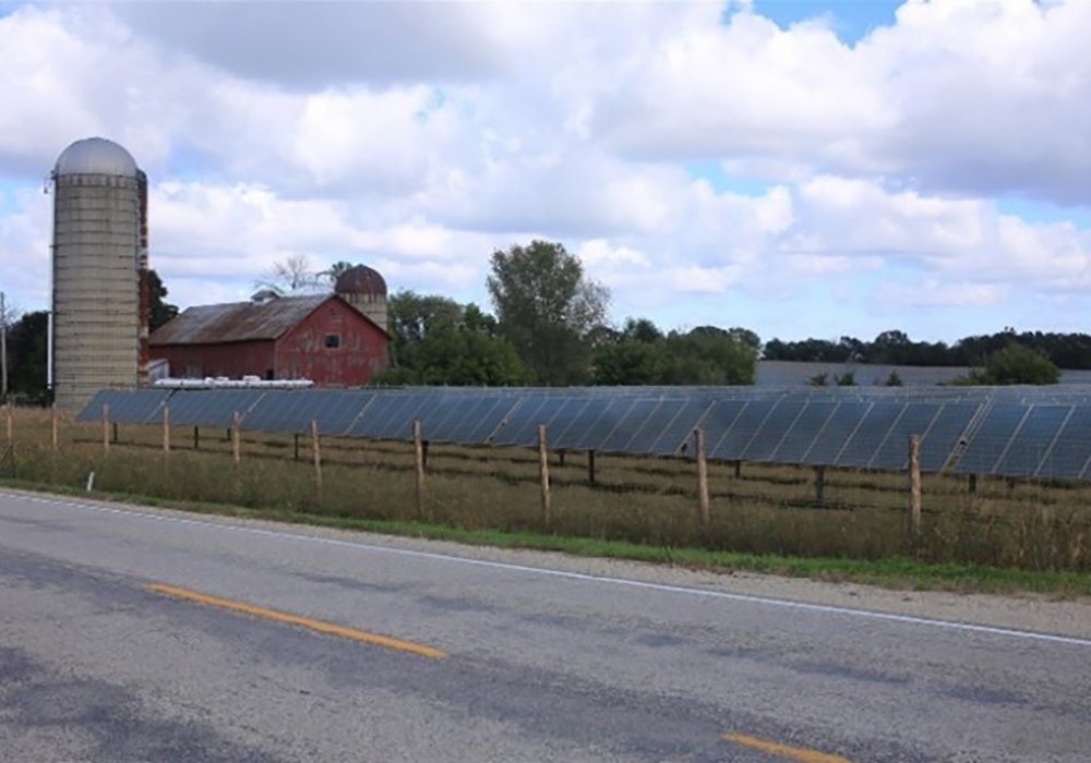
Show a solar project simulation like this before your imaginations run wild. (Credit: Stantec)

The Ivanpah concentrating solar power station in San Bernardino County, California (Credit: Craig Butz, Wikimedia)
Early Simulations Clarify Project Visuals Efficiently
This gets to what some developers understand about the value of sharing simulations early on, even when doing so is not required by a defined permitting process. They understand the need to establish the parameters of deliberation by showing what their project will — and what it will not — look like, even if the layout is not final. This last point is crucial. Whatever cost there might be to revise simulations for the formal permit application should be weighed against the cost of delays associated with refuting perceptions that have taken root for the lack of any representative imagery at all.
Cities, towns, and counties have an interest in achieving a shared visual understanding, too. Opposition may not go away just because there is agreement on a project's visual characteristics, such as its visibility and prominence in valued views. But with the elimination of contention at that very basic level, community deliberation can focus on specific aspects of project visibility that may be of concern, or on other issues altogether.
Finally, there are other reasons to show instead of just tell.
Visualization is an efficient way to convey design features that anticipate or respond to community concerns, such as setbacks. The modeling process can also indicate where existing vegetation or proposed landscaping would screen a project.
The urgency with which we must facilitate the energy transition cannot come at the cost of stakeholder outreach, but it does make it imperative that such outreach processes be efficient. Ensuring a shared understanding of precisely what is proposed so that productive deliberation of a project on its merits can commence as quickly as possible can certainly help with that.

A simulation of a large solar project demonstrating how it would be set back from the roadway and partially screened (Credit: Stantec)

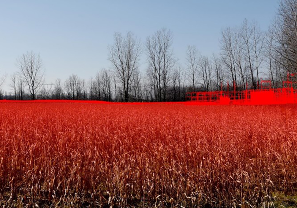
A wireframe simulation demonstrating how a proposed solar facility's substation would be almost entirely screened by foreground vegetation (Credit: Stantec)

Solar@Scale is a partnership between the International City/County Management Association (ICMA) and the American Planning Association (APA) that aims to help cities, towns, counties, and special districts understand and realize the potential benefits of large-scale solar development.
Have a question about Solar@Scale or want to share your experiences with planning and zoning for large-scale solar development? Contact solar@planning.org. Interested in hosting a regional workshop? Let us know.
Top image: Getty Images


