Planning March 2020
Et Cetera
Mapped: The Nexus of Infrastructure and Opportunity
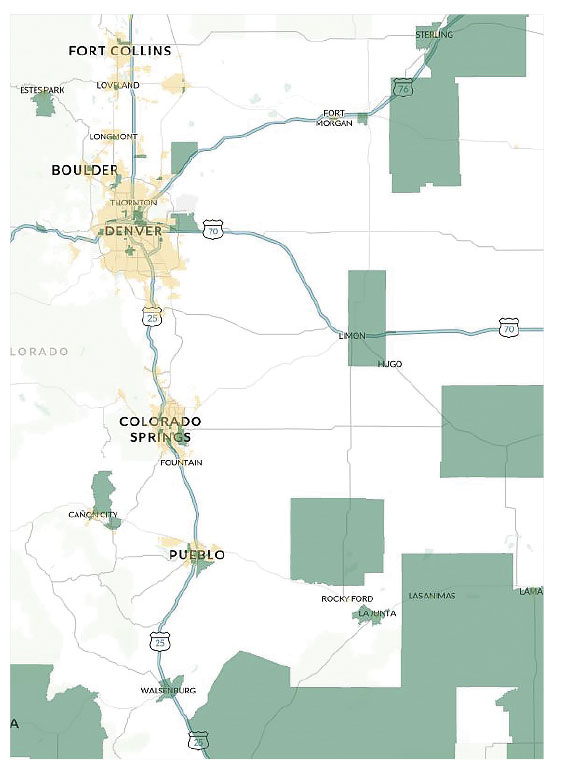
Some people have to see it to believe it, which is why the U.S. Department of Transportation has created an interactive map displaying information on federal investment, specifically toward infrastructure projects in and around Opportunity Zones.

The new interactive map links Opportunity Zones (shown in green near Denver above) with transportation infrastructure. Map courtesy U.S. Department of Transportation.
OZs "have the potential to increase job creation in underserved communities, especially in rural areas," said Secretary of Transportation Elaine Chao in a statement, "and the department is working to ensure there are transportation links to OZs."
The tool offers visualizations and detailed attribute tables for a long list of datasets, including major federal highway projects and information on bus, rail, air, and seaports. It also includes features to add and layer new data, allowing users to develop custom insights.
OZs offer tax advantages for investments in underserved communities. (See "Adventures in the Land of OZ," Planning, June 2019.) Federal infrastructure investment in and around OZs suggests a more supportive surrounding for new development versus areas experiencing complete disinvestment. Whether putting capital into a housing project or commercial developments, a strong transportation network is crucial for socio-economic viability, and understanding current and planned infrastructure projects allows for informed decision making.
Kate Calabra is a partnership development associate at City Tech Collaborative in Chicago.
Exhibit: What's Past Isn't Just Prologue

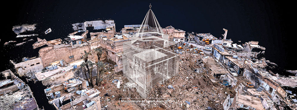
Through digital reconstructions like the above exhibit, Age Old Cities offers an immersive experience of architectural preservation. Photo courtesy Arab World Institute, Paris/ICONEM.
A new Smithsonian exhibit at the Arthur M. Sackler Gallery in Washington examines three ancient cities: Palmyra and Aleppo in Syria and Mosul in Iraq. After the three-year battle over ISIS occupation of Mosul, "not a single structure is unscathed," according to UNESCO.
Age Old Cities: A Virtual Journey from Palmyra to Mosul offers large-scale projections and digital reconstructions of the world-renowned monuments and structures in these places that have recently been ravaged by war. The exhibit shows how the technology can be used to not only remember the past, but to also build the future of these cities. Created by the Arab World Institute in Paris, the exhibit runs now until October 26.
Jim Sweeney writes about architecture, art, design, and science from Rockville, Maryland.
Planners Playlist: How and Why Land Matters

The Lincoln Institute of Land Policy is providing a "behind-the-scenes look at what makes cities tick." From tax increment financing to the latest episode on global agreements like the United Nations Sustainable Development Goals, the Land Matters podcast surveys the ways land use solves — and creates — some of planning's biggest headscratchers.


