Sponsored Content
Embracing User-Centered Zoning Codes

Sponsored Content from General Code
Over the past hundred years, zoning regulations have become increasingly complex. Traditional residential, commercial, and industrial zoning districts have expanded to include multiple property subcategories and detailed overlay districts. Changes like these have made it challenging for property owners to understand and interpret their community's plan for the future — and how it may affect their property or neighborhoods.
Conveying Complex Zoning Information Lacks User-friendliness
As the content of zoning codes has changed dramatically, how these regulations are communicated to the public has remained relatively unchanged. Many municipalities continue to present their zoning codes as static, text-heavy documents that property owners often have to wade through to find information about a particular zoning district. Traditional code publishing and updating methods have also not done a good job of communicating graphically rich content such as form-based codes, hybrid codes, and large color-coded and highly formatted use tables.

MapLink is a service that presents the essential elements of your community's zoning code through an interactive online map. Photo courtesy General Code.
Transitioning to an Online, User-centered Zoning Experience
Many municipalities are adopting a more user-centered approach to zoning challenges by utilizing new tools such as interactive zoning maps. With this technology, business owners can simply click on a map to quickly reveal essential elements about a property or area they are interested in. More advanced versions of the technology tie GIS maps to granular zoning code information with links back to regulating code text that is easy to understand, well laid out, and graphically rich.
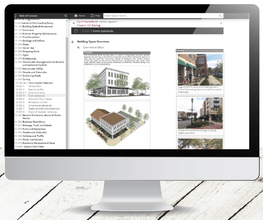
Several municipalities are also experimenting with enhanced graphic methods to keep high-resolution images, in-line tables, multi-page layouts, and other graphically-rich code content true to the original zoning document as it is updated. The process helps to ensure that highly graphical zoning codes are always clear and easy to navigate in print, online, and mobile formats.

Enhanced Graphics lets you optimize the presentation of your zoning code in print and online media without compromising the original planning document's design. Photo courtesy General Code.
Maximizing Effectiveness in Serving Clients and Constituents
The goal of these new user-centric technologies is to support planners in getting back to performing high-value planning work, versus answering constituent questions, performing tedious code updates, and reproducing or reformatting zoning code content for different uses.
The current world situation has created new rules for citizen engagement in the future, and those new rules demand that we leverage newly available digital solutions to maximize our effectiveness and efficiency in serving the needs of our clients and constituents. Making zoning codes more accessible and user-friendly is just the beginning of a positive trend.
Resources
General Code. "Interactive Online Map Simplifies How Easton Navigates its Zoning Code." Generalcode.com (Accessed May 2020)
General Code. "Enhanced Zoning Graphics: Stay true to your community's vision in your online zoning code." Generalcode.com
Governing – The Future of States and Localities. "Human-Centered Design for Government." Governing.com (Accessed May 2020)
Government Technology (GT). "Is User-Centered Government Really Attainable?" Govtech.com, (Accessed May 2020).
Top image: User-centric zoning. Photo courtesy General Code.
About the Content Author and Sponsor: General Code

General Code is a recognized leader in creating custom digital solutions designed to ensure that municipal, building, and zoning code information is clearly presented and easily accessible to local communities. By intelligently connecting ordinances, zoning codes, and other vital information in a digital environment, our 3,000+ client communities can more effectively address common challenges and actively support growth opportunities.


