


Equity in Practice
AI and Community Knowledge Help Planners Better Understand Gentrification
summary
- Artificial intelligence (AI), machine learning, and community knowledge can help planners identify new-build gentrification and neighborhood change.
- Researchers from Drexel University and Temple University used computer vision, Google Street View imagery, and resident focus groups to map local signs of gentrification in Philadelphia neighborhoods with 84 percent accuracy.
- Combining explainable AI with qualitative research can support equitable development, anti-displacement planning, and community-informed decision-making.
Gentrification often does not occur overnight; it unfolds gradually, with changes that may appear minor at the time before they almost completely transform a neighborhood. Studies have found that gentrification can disrupt long-established social networks, weaken cultural identity and community institutions, contribute to displacement and housing instability, cause financial hardship, and create chronic stress as residents face uncertainty about whether they can remain in the neighborhoods they have helped shape.
Since gentrification can unfold in slow-moving increments, it has been hard for planners to identify meaningful patterns before displacement occurs. Traditional demographic and economic indicators often reveal neighborhood transformation only after significant changes have already taken place.
But a team of researchers at Drexel University and Temple University is exploring if pairing artificial intelligence (AI) with community knowledge and qualitative research can help planners identify neighborhood change sooner while also gaining better insight into the driving factors. In a study published in PLOS ONE — written by Maya Mueller and coauthors — the team built machine learning models that correctly identified 84 percent of the physical characteristics associated with new-build gentrification in their study area in Philadelphia.
Using Community Context to Build a Better AI Tool
Mueller became interested in better understanding gentrification after speaking with Philadelphia residents about redevelopment and displacement in her neighborhood. What began as a single research idea evolved into a collaboration with a multidisciplinary team of experts in geography, environmental studies, engineering, data science, architecture, and machine learning, including doctoral student Isaac Quaye; Hamil Pearsall, PhD; Simi Hoque, PhD; along with other researchers.
Using thousands of historical Google Street View images, the researchers trained a computer vision model to recognize architectural characteristics typically associated with new-build gentrification. They also incorporated explainable artificial intelligence (XAI), which allowed researchers to determine whether the model was focusing on the architectural features associated with neighborhood change.
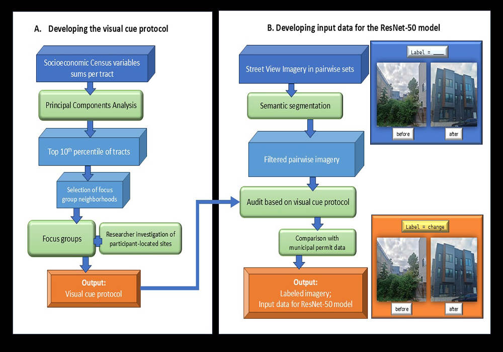
Flowchart for developing and implementing the image recognition model. Image provided by research team.
The project reinforces how important transparency is when working with artificial intelligence. The researchers grounded the AI-driven findings by combining it with qualitative research that captured the context and on-the-ground, lived realities. With funding support from a National Science Foundation award, the team conducted property-by-property virtual field audits using historical Google Street View imagery in two census tracts encompassing parts of Philadelphia's Fishtown and Norris Square neighborhoods. They also held focus groups with longtime residents from Norris Square, Port Richmond, and Tacony. The virtual field audits documented physical changes over time, while the focus groups offered insight into how residents experienced redevelopment and identified changes that were not readily apparent through imagery alone.
Longtime residents described architectural styles that "stick out like a sore thumb" and identified neighborhood changes beyond new construction, such as the loss of trees and community gardens, as well as environmental concerns. Participants also noted shifts in the types of businesses serving the neighborhood. An unrelated but relevant study using Yelp data found that the arrival of Starbucks and other coffee shops can serve as an early indicator of neighborhood change, illustrating how changes in commercial activity often accompany broader patterns of gentrification.
These observations helped Mueller and her team translate residents' descriptions into architectural characteristics that could be incorporated into the AI model while also broadening their understanding of how neighborhood change is experienced. Residents who had lived in their neighborhoods for decades "had a mental map in their heads of every single property," Mueller says, "and what it had changed into, and what it was before."
Although the original emphasis was on developing forecasting models, the team became concerned that forecasting alone could unintentionally encourage redevelopment in neighborhoods identified as vulnerable to gentrification. "We thought it would be beneficial to have more of an explanatory aspect," Mueller says.
Takeaways for Planners
The interviews with residents also revealed the limitations of relying on technology alone. While the computer vision model recognized architectural patterns with a high degree of accuracy, virtual field audits and conversations with longtime residents revealed important changes not readily apparent through imagery. Those observations helped researchers translate lived experience into measurable characteristics, strengthening the overall analysis.
The project also reinforces how important transparency is when working with artificial intelligence. Rather than relying solely on algorithmic outputs, the researchers demonstrated the value of grounding AI-driven findings in qualitative research that captures context and the on-the-ground, lived realities that models may overlook. By using explainable XAI, the researchers could see how the model was making its decisions instead of just trusting the outputs. When they combined that with input from the community, it helped confirm the model’s results.
Looking ahead, Mueller says the team is continuing to build on their research by developing new machine-learning models that look at a wider range of factors influencing neighborhood change. They are also working on models that can equip planners and policymakers with tools that better reflect the unique conditions of individual neighborhoods, recognizing that the factors driving gentrification differ from one community to the next.
For planners, especially those focused on more equitable development, the research suggests new technologies can help spot patterns of neighborhood change earlier than traditional demographic or economic data alone. However, the project also makes it clear that AI-produced data should not be used on its own, emphasizing the irreplaceable value of community knowledge and treating community members as partners in the process.
While the research team is still refining its approach, Mueller says this tool is improving the ability to incorporate community perspectives into AI models.
AI in Planning Use Case Database
APA has created the AI in Planning database that contains more than 70 examples (and growing) of AI use in planning and local government practice both in the U.S. and abroad. It is structured according to planning practice areas, planning processes, type of AI technology involved, and the role of AI in the workflow.
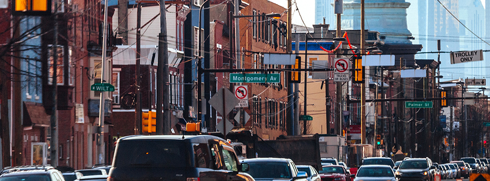
Top Image: View in Philadelphia's Fishtown neighborhood. iStock/Getty Images Plus - peeterv