May 8, 2026
Artificial intelligence (AI) technologies are rapidly becoming embedded in the systems that shape the future of our communities and the everyday work of planners. Across the globe, governments are deploying AI-based tools to meet planning needs. New pilot projects, experiments, and protocols offer creative and promising examples of how AI can expand planning capacity, while also raising important ethical questions, potential risks, and implementation challenges.
Update your toolkit
AI can do more than copyedit a report or analyze hundreds of lines of data. Emerging applications of AI include internal process automation, community development initiatives, mobility solutions, public safety, and streamlined permitting.

Photo courtesy of DSB/Netcompany.
AI SWARM
Project Status: Complete, 2025
In Denmark, where only 8 percent of residents regularly ride trains, delays were something Danske Statsbaner (DSB) officials knew they needed to solve. They partnered with multiple AI companies to create a delay model in which a "swarm" of smaller AI models separately analyzed different stations, delay factors, and more to create the most accurate picture of what causes delays. The swarm model can now predict a delay within three minutes at 95 percent accuracy. DSB has been able to address delays with more precision and improve on-time service for riders.

Image courtesy of City of Hernando County, Florida.
PERMITTING, STREAMLINED
Project Status: Ongoing, launched 2025
After Hurricane Milton damaged homes and infrastructure in 2024, causing an influx in new building applications, Hernando County, Florida, employed an AI that can read permit applications and compare them to zoning requirements to determine code compliance. This process, which used to take the county 45 to 60 days, now can be completed in two to three minutes. As natural disasters increase in climate-vulnerable places, streamlining the permitting process will be a necessity for planners.

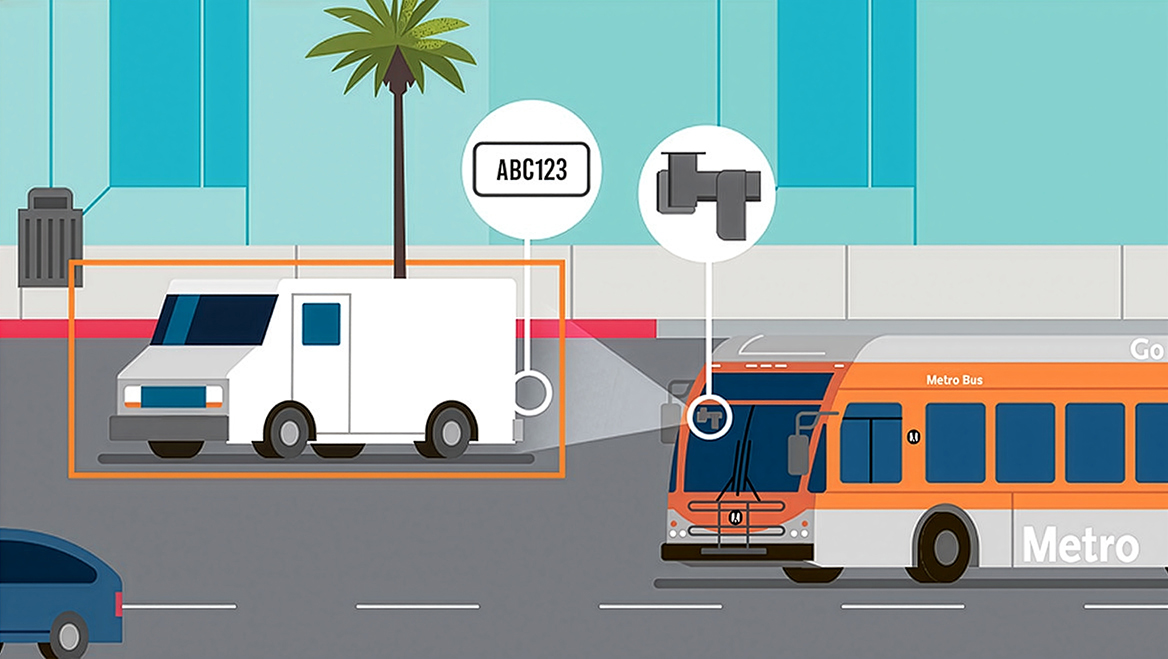
Photo courtesy of Hayden AI.
TICKETING PROGRAM
Project Status: Complete, 2024-2025
Cameras, which use machine learning AI to identify cars parked illegally, were mounted on bus windshields on two Los Angeles Metro lines in November 2024, with ticketing beginning the following February. The cameras produce an "evidence package" that includes photos and information such as vehicle license plate number and the incident date and time for a human to review. By April 2025, Metro had issued nearly 10,000 tickets and expanded the program to two more bus lines. This program further incentivizes drivers to stay out of bus lanes, improving travel time and experience for transit riders.

Photo courtesy of SensoRy AI.
SPOTTING WILDFIRES
Project Status: Ongoing, launched 2022
The Orange County Fire Authority in California has implemented a preventative monitoring system using multiple AI systems that spot new wildfires and alert authorities before they have a chance to spread. In January 2025, one detection system spotted its first fire at 2 a.m. in a remote area of the county, where a 911 call about the fire would have been unlikely. The system has the potential for widespread application across other disasters in many locales. Planners must increasingly address the impacts of hazards in environmental and infrastructure planning efforts. Projects like these could make those processes more effective and could potentially save lives.

Image by Haozhuo Yang (TangiblEmpact/Harvard GSD).
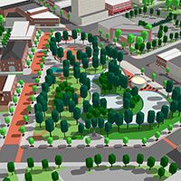
WALKABILITY STUDY
Project Status: Complete, 2025
Researchers in Hong Kong used visual AI to determine ease of mobility for older residents along city streets. The study, conducted by Perkins Eastman, used object detection and image segmentation to identify elements of a street, then paired the frequency of those elements with survey data about where elderly people choose to walk. A higher frequency of benches and trees was found to have the closest positive relationship to a high percentage of walkers. This study can be modeled in other cities to determine what street elements are most desirable to walkers and where those elements are lacking.
Stay tuned!
The American Planning Association (APA) continues to monitor emerging use cases of how AI is being used to maintain planning function and plans to provide a comprehensive database later this year.
RECOMMENDED ARTICLES